Important disclaimer:
This is a working website to support information exchange and collaboration.
Contents of this website are not Necessarily representing final results or official statements.
|
|
|
|
OUR GOAL
WARMA and WWF-Zambia are collaborating with other ministries of the Zambian Government
to identify and map potential surface Water Resource Protection Areas (WRPAs) for Zambia.
The following three criteria are used to define a WRPA:
WARMA and WWF-Zambia are collaborating with other ministries of the Zambian Government
to identify and map potential surface Water Resource Protection Areas (WRPAs) for Zambia.
The following three criteria are used to define a WRPA:
- The area is of high importance in providing water to users in a catchment
- The area is of high aquatic ecological importance
- The water resources of the area are particularly sensitive to use and anthropogenic impact
OUR APPROACH
Our scientific approach is built on three components:
a scientific framework; stakeholder engagement & capacity building; and the use of advanced geospatial datasets.
Our scientific approach is built on three components:
a scientific framework; stakeholder engagement & capacity building; and the use of advanced geospatial datasets.

|
|
|
|
The scientific framework
The WRPA project was guided and supported by a team of researchers, both from government and academic institutions. Consultancy on technical and data processing issues was provided by Prof. Lehner of McGill University, Canada. In-country expertise was provided by University of Zambia and others.
|
Stakeholder engagement
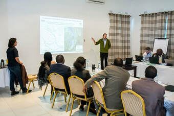
and capacity building We conducted a series of stakeholder workshops from 2017 to 2019 in Lusaka, Zambia, to present and discuss the methods and results.
We also conducted and continue to offer capacity building through GIS training. Please contact us for more information. |
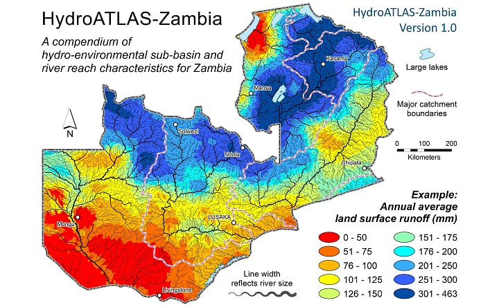
The HydroATLAS-Zambia database
To serve as the main data repository in the identification of WRPAs, we created a geospatial database called HydroATLAS-Zambia which provides hydro-environmental characteristics for all catchments and rivers of Zambia in GIS format. For more information regarding this database (and free download) please go here.
|
MAIN OUTCOMES
During the WRPA project, a national assessment was conducted which developed a methodology and analytical framework to characterize each sub-catchment and river reach of Zambia for their importance regarding the three criteria defined for the nomination of Water Resource Protection Areas, to rank them, and to prioritize WRPA candidate sites.
The results of this assessment are fully described in a technical report available here (in low resolution - 6 MB) or here (for download in high resolution - 32 MB).
The data supporting this projects as well as the results in GIS format can be found here.
NEXT STEPS
- Launch of HydroATLAS-Zambia
- Gazetting of selected areas
